
Riverine Systems: Hydraulics & River
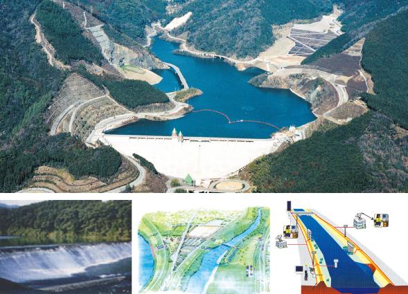
West JEC has expertise in a wide range of technical services related to management of river systems. Areas of our expertise include planning of flood control and water utilization facilities, planning, design, management and operation of dams, survey and design of river facilities and hydro-power facilities, and river management using optical fiber IT systems.
- Making river improvements and planning river maintenance policies
- Planning operation and maintenance of dams for flood control, water usage, and other purposes
- Planning environmental management of rivers and restoration of
rivers to their natural states - Planning for environmental water preservation and landslide control
- Planning and design of embankments and retaining walls
- Planning and design of sluice gates, pipes, flood gates, and so forth
- Planning and design of artificial rivers, biotopes,and fishways
- Planning and design of IT facilities related to river management
- Planning, design and implementation of dams and landslide control facilities
- Planning of dam intake and discharge facilities and dam management facilities
- Redevelopment of dams, embankments, and dam facilities and overall dam inspection
- Design implementation and planning of hydropower facilities and aqueduct tunnel
- Planning of power generation for dam control
River Basins and Coastal Zones
Coastal zones are sensitive to impacts from both land and sea. These zones are also predisposed to disasters such as earthquakes and tsunamis. Consequently, earthquake- and tsunami-resistant structures are needed for coastal zones. Measures to compensate for subsidence are also necessary. West JEC is located in Japan, a country surrounded by coastal and reclaimed areas and stricken frequently by natural catastrophes. West JEC has acquired extensive experience and technology for dealing with these issues. Long term expertise and high level technology permits West JEC to provide a wide range of services for the development and utilization of coastal zones. Doing this contributes to making Japan a place resilient to disasters and a place where society can be in symbiosis with nature.
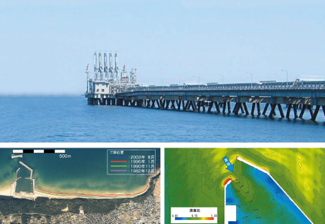
Studies of coastal deformation
using aerial photography and GIS technology
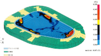
Evaluation of bay tranquility
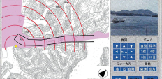
Design of surveillance camera control systems
- Planning and design of harbor facilities
- Planning and design of fisheries infrastructures
- Implementation of countermeasures for weakly-structured terrain
- Planning and design of marine wind power generation systems
- Design of disaster management telecommunication systems
- Diagnosis of structural strength and seismic integrity and design of structural repairs
- Analysis of ocean waves and currents and of wind flows
- Coast deformation analysis
- Coastal protection planning
- Investigation and design of estuaries processes
- Comprehensive management of sediments
- Design of storm fences and other countermeasures for drifting sand
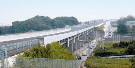
Road, Bridge and Community Cable Box Design
To create a more harmonious environment for humanity, our road and bridge engineers design and supervise construction of roads, bridges, and community cable boxes (CC Boxes). They also supervise installation of power transmission cable in underground conduits and on bridges, using technologies which are friendly to people and the natural world.
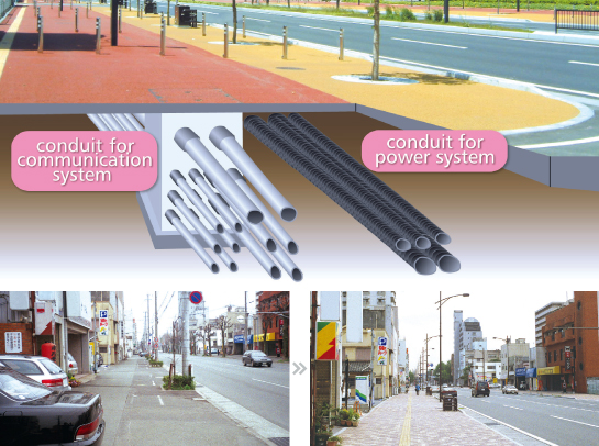
Planning and design of installations of underground cables with CC Boxes
Planning and design of roads and bridges
- Planning and design of road structures
- Planning and design of roads, bridges, road-appurtenant facilities, and roadside slopes
- Road disaster prevention inspections
- Planning and design of tunnels
- Planning and design of tunnels
- Computerization of CC Box control registers
- Planning and design of installations of underground distribution power lines
- Planning and design of installations of distribution power lines on bridges
Regional and Urban Infrastructure
West JEC's urban, water, and sewerage engineers have developed proven technologies and acquired broad experience in regional and urban planning for river systems, from headwater forests to marine estuaries. We assist governments in creating bright, active communities. These communities manifest their unique history, culture, and landscape. To do this, we utilize model landscape dioramas and state-of-the-art GIS technologies, to propose regional development plans, countermeasures for industrial waste and construction byproducts, measures for utilization of unused energy resources, and so forth.
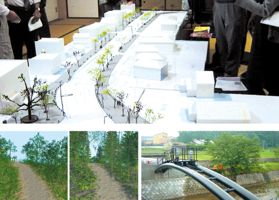
Natural environment revitalization
image scenery using CG
Sewerage conveying pipe
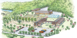
Image drawing of an exhibit facility
- Regional planning, urban planning,landscape design and park design
- Survey, planning and design of water and sewerage systems and industrial water systems
- Survey, planning and design of environmental preservation facilities and renovation of river, road and harbor facilities
- Planning and design for utilization of information technology
- Survey, planning and design of recycling of construction byproducts and industrial waste
Power Transmission and Transformation Facilities
We carry out survey, planning, design, and maintenance management of power transmission facilities. We also support construction of mobile phone relay stations, in order to cope with the ever-increasing number of phone subscribers and to enhance transmission quality.
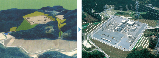
- Planning, survey, design and construction supervision of the
foundations for power transmission lines. - Survey, design and construction supervision of substation sites.
- Environmental information study for transmission line routes and substation sites.
- Survey, design and construction supervision of relay stations for mobile phone networks.
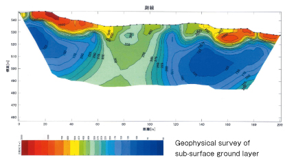
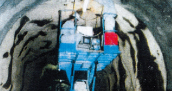
Investigation and Research
Our engineers survey, test, and analyze subsurface ground layers and ground water for structures under construction on an integrated service basis. They also make various measurements and conduct soundness diagnoses. When implementing these studies and tests, we aggressively develop and utilize new technologies in order to minimize total cost.
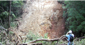
Slope disaster surveys

Laboratory testing
Surveys of the concrete structural soundness
- Surface reconnaissance and analysis on wide-area geology and underground water distributions
- Implementation and analysis of boring, various in-situ measurements and laboratory tests for civil structure foundations
- Emergency surveys of ground conditions and preparation of applications for disaster support in the event of natural disasters caused by earthquakes and landslides
- Soil contamination surveys and analyses
- Concrete testing, analysis of concrete structural soundness, and remaining-life assessments
- Asphalt testing
- Measurement, analysis and assessment of ground deformation
- Geophysical surveys of subsurface ground layer
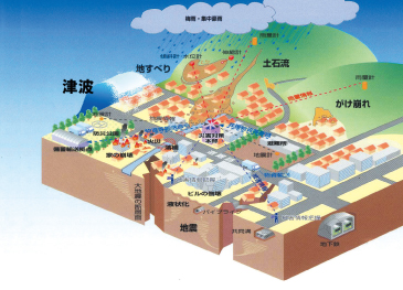
Information and Disaster Management
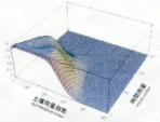
West JEC's information disaster management engineers utilize geographic information systems (GIS), remote sensing technologies, and numerical simulation technologies in order to evaluate the potential impacts of disasters such as earthquakes, landslides, deluges, and tsunamis, and to construct resilient systems for dealing with such disasters.
In addition, we carry out environment assessments on subjects such as groundwater recharge, water quality preservation, and flow distribution of thermal waste water.
- GIS (Geographic Information System)Optimal site locating programs, optimal route selections, and environmental impact assessment for construction of structures
- Feasibility studies Studies to assess the priorities of
remedial work for facilities hit by landslide disasters,
based on Data Envelopment Analysis (DEA) - Disaster Management system Construction of support systems for
dealing with disasters Construction of landslide warning systems Assistance in implementation of disaster chart exercises (DIG) - Simulation Technologies Flooding estimates and assessments of potential structural integrity impairments by using methods of tsunami analysis Evaluations of earthquake resistance by utilizing methods of seismic response analysis Environmental impact assessments using methods of underground water flow analysis
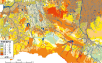
- Remote Sensing Analysis Data acquisition regarding the extent of disaster damage Support of environmental studies and land use surveys
Seismic Response and Earthquake Resistant Design
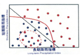
Construction of Landslide Warning System
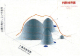
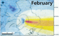
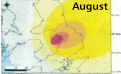
- Ash Fall Simulation based on TEPHRA2
